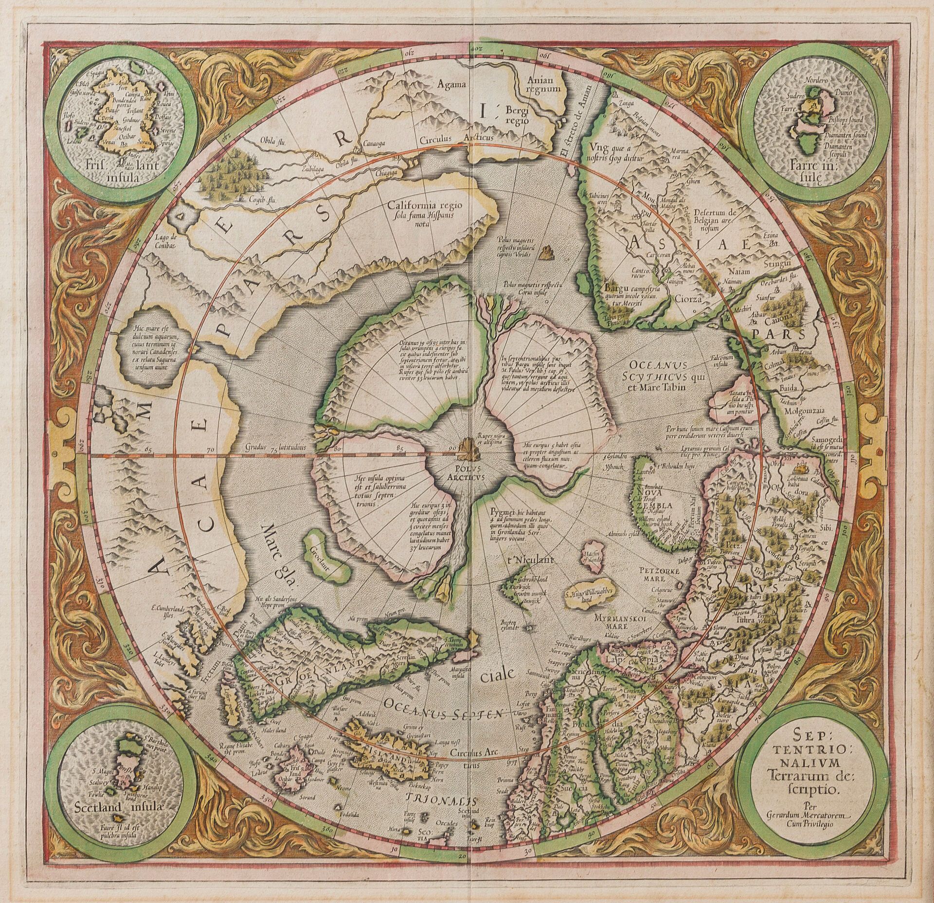
MERCATOR, G. Septentrionalium Terrarum descriptio. Amsterdam, 1633. Fine contemporary col. French text on verso. Marked central fold. Minor foxing. Not examined out of frame. 365 x 390 mm Compiled by Gerard Mercator himself, this is the first separate map of the Arctic. Largely based on his own world map of 1569, Mercator's map in fact draws on much earlier sources, starting with Ruysch's world map of 1507, and going all the way back to the late 14th-century Inventio Fortunata, attributed to Nicolas de Lynn, which describes the lands north of the 54th parallel. The present map also contains circular cartouches showing "Frislant insula, Farre insulae" and "Scetland insulae", and covers Northern Europe, Asia and America, as well as Greenland and Iceland. It is somewhat disconcerting that California lies well north of the Arctic Circle. However, recent discoveries by Davis and Frobisher are clearly represented. The map is an edifying synthesis of contemporary geographical concerns about the Arctic, with its four great islands at the top of the world, the Anian Strait and the promise of a Northwest Passage. - Burden, North America, 88, state 2. - Koeman/van der Krogt, I, 311
Estimate
€500 - €800
Result
€1,582
Buyer's premium
30%
MERCATOR, G. Septentrionalium Terrarum descriptio. Amsterdam, 1633.
Fine contemporary col. French text on verso. Marked central fold. Minor foxing. Not examined out of frame. 365 x 390 mm
Compiled by Gerard Mercator himself, this is the first separate map of the Arctic. Largely based on his own world map of 1569, Mercator's map in fact draws on much earlier sources, starting with Ruysch's world map of 1507, and going all the way back to the late 14th-century Inventio Fortunata, attributed to Nicolas de Lynn, which describes the lands north of the 54th parallel. The present map also contains circular cartouches showing "Frislant insula, Farre insulae" and "Scetland insulae", and covers Northern Europe, Asia and America, as well as Greenland and Iceland. It is somewhat disconcerting that California lies well north of the Arctic Circle. However, recent discoveries by Davis and Frobisher are clearly represented. The map is an edifying synthesis of contemporary geographical concerns about the Arctic, with its four great islands at the top of the world, the Anian Strait and the promise of a Northwest Passage.
- Burden, North America, 88, state 2. - Koeman/van der Krogt, I, 311
Sale
Tuesday 1 October 2024・13:30 (Europe/Paris)
Salle 4 - Hôtel Drouot
9, rue Drouot
75009 Paris